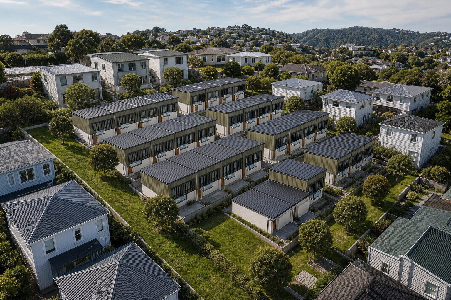
10 Hillview Crescent · Paparangi, Wellington
A property listing is more useful when it arrives with a feasibility study.
Listing · shared brief · early feasibility · next decisions
This Paparangi study shows what an agent, developer and architect can establish before their first project meeting.
The opportunity is a property market where a listing arrives with an informed first view of what the site could support. An agent contributes market evidence, a developer applies the commercial knowledge of the business, and an architect tests the site against past models and design experience. When those inputs are structured and reusable, each firm's accumulated knowledge becomes available while the opportunity is still live, giving all three a shared proposition for the first conversation.
The example starts with 10 Hillview Crescent, a 4,671-square-metre Paparangi site marketed in March 2026 with consent for thirty townhouses. The study combines the public listing, consent decision, LINZ parcel and LiDAR data, cost assumptions and market evidence available at the time.
The result is an early conversation pack: indicative site constraints, a scheme that can be reviewed, a feasibility scenario and a clear list of information still required. It does not establish the property's current ownership or availability.
- Consented
- 3013 three-bed · 15 two-bed · 2 one-bed
- Site
- 4,671 m²single title, dual street access
- Modelled fall
- 16.1 mindicative terrain study
- Scenario result
- $1.17millustrative residual · advertised-price case
One shared brief gives the agent, developer and architect a useful first view.
Jim is a fictional townhouse developer who also runs a building company. His brief records the projects he wants, the rates he trusts, his margin hurdle and the evidence required before a site progresses.
An agent can apply that brief before calling him. An architect can test the indicative terrain against the firm's previous housing models and design knowledge. Jim then receives one pack showing the opportunity, the assumptions and the next investigations.
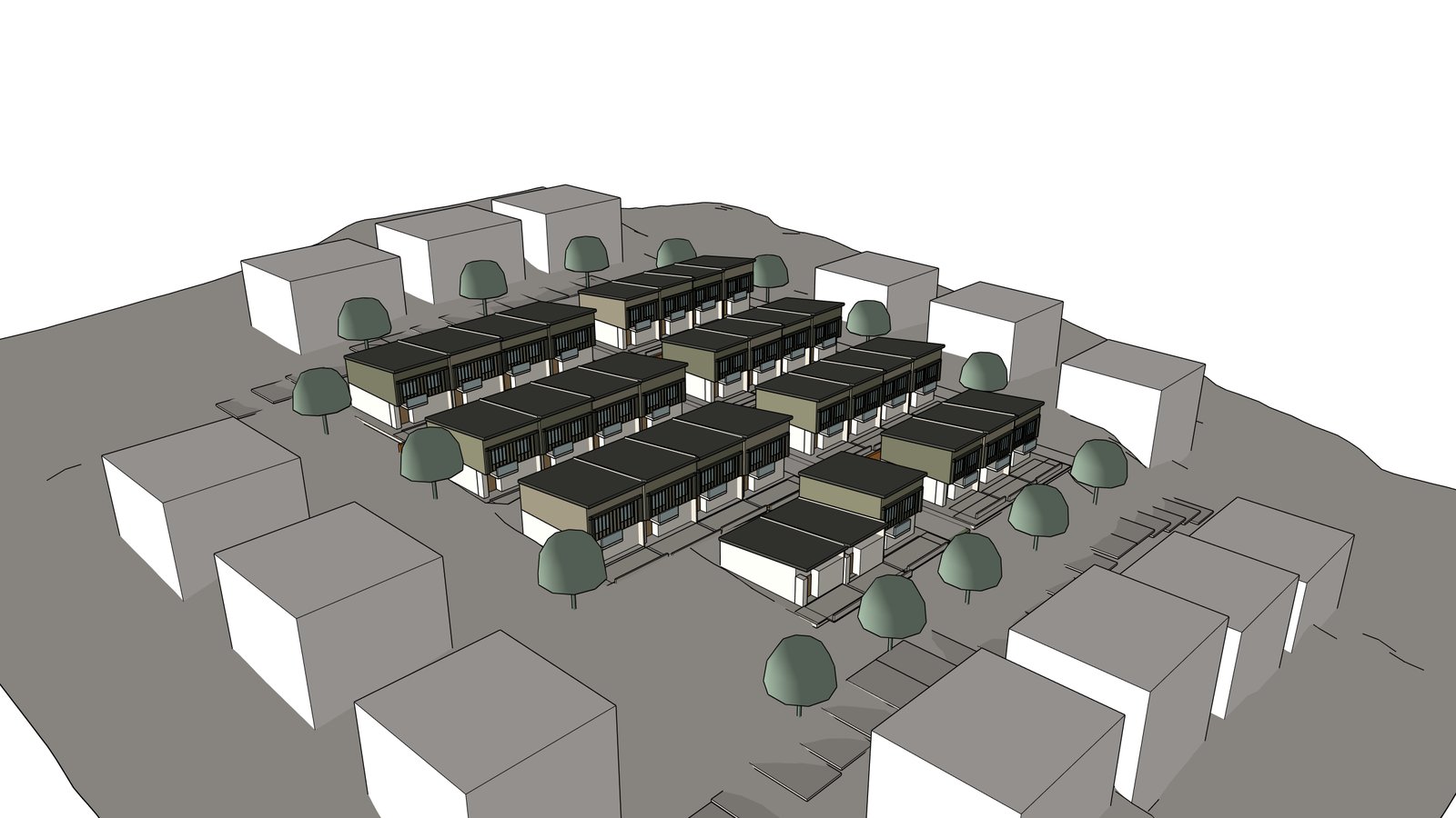
Current direction · Retain the consented mix and test four benches along the contour, with the gaps aligned as a planted route.
Listing, title, consent status and sale method held against the developer brief.
The modelled 16.1-metre fall moved the layout to four along-contour benches.
Site evidence, scheme, source labels, assumptions and illustrative land residual.
Unbranded working example adapted from the in-organisation mockup. No agency, developer or client data is shown.
The agent prepares market evidence
The agent contributes the listing context, settled sales and a reasonable pricing range for the homes that may result.
The developer applies business criteria
The developer contributes delivery costs, margin requirements and the project types that fit the company's capability.
The architect tests a scheme
The architect contributes site interpretation, relevant past models and early design options that can be tested against the brief.
The first check tests the listing description against open terrain data.
The process combines the LINZ parcel with a one-metre LiDAR surface. At Paparangi, this changed the reading of the site. The listing described near-flat contours; the terrain model records 16.1 metres of fall across the study area at a mean slope of 12.5 degrees, with 29 percent of the ground steeper than 15 degrees.
This desk study positions the terrain window from a street-level geocode rather than surveyed title coordinates. The figures describe the immediate ground and remain indicative until they are checked against a topographical survey and the title boundary.
The modelled fall changes the scheme direction. Four benches run along the contour, each levelled to balance its own cut and fill. The first direction ran across the fall and required a seven-metre cut per bench, so it was discarded.
| Bench | Dwellings | Level | Cut | Fill | Retaining |
|---|---|---|---|---|---|
| Block A | 8 | +3.79 m | 518 m³ | 518 m³ | 72 m |
| Block B | 8 | +1.14 m | 389 m³ | 389 m³ | 66 m |
| Block C | 8 | –0.56 m | 391 m³ | 391 m³ | 40 m |
| Block D | 6 | –2.42 m | 294 m³ | 294 m³ | 44 m |
| Total | 30 | 1,593 m³ | 1,593 m³ | 222 m |
Each bench balances its own earthworks. The benches step 2.6, 1.7 and 1.9 metres between terraces. Bench values are rounded, while the total is calculated from the unrounded model. All levels, volumes and wall lengths are indicative concept quantities derived from the LiDAR surface.
The developer brief gives the architect a scheme worth testing.
For this example, the brief retains the consented mix of thirty dwellings: thirteen three-bedroom, fifteen two-bedroom and two one-bedroom. Each bench carries two short clusters, replacing four unbroken terraces of eight. The gaps align across the benches to form a planted route through the centre of the site.
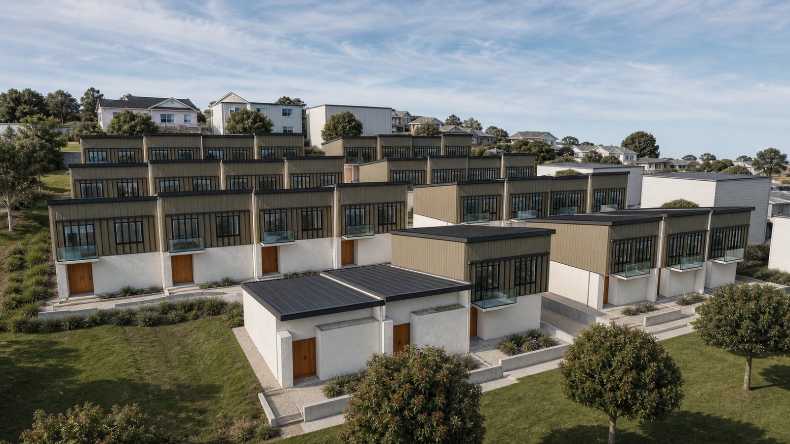
The upper floor projects 600 millimetres over a recessed entry. Ridge heights and setbacks vary along each cluster, while the two single-storey one-bedroom homes step the scheme down beside neighbouring houses. These are early choices for the architect and developer to review together.
- Mix
- Matches the consent: 13 × 3-bed, 15 × 2-bed, 2 × 1-bed
- Design model area
- 2,951 m² · 98 m² average
- Section
- 2.75 m floors · 0.95–1.35 m mono-pitch rise · 600 mm cantilever
- Materials
- Light plaster base, khaki-olive battens, charcoal standing-seam roof, cedar entry doors
- Outdoor
- Private yard at ground, balcony beside every entry
The feasibility tests a land value under stated assumptions.
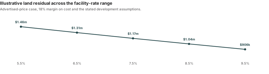
The base case carries $480,570 per dwelling before land, finance and margin, an 18 percent margin hurdle and a 7.5 percent facility rate. The commercial model retains 2,814 square metres of net saleable area, 4.9 percent below the 2,951-square-metre design model. This preserves the more conservative area allowance used in the original feasibility.
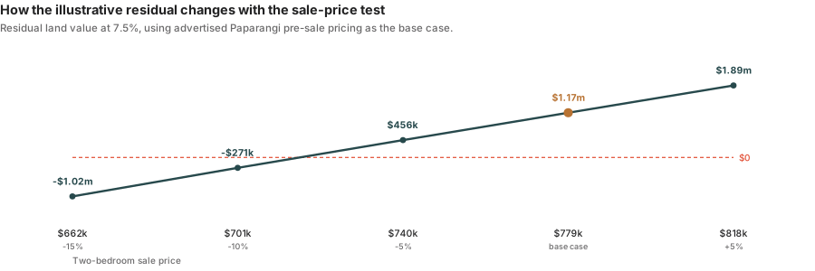
The two-bedroom sale-price test is $779,000, taken from advertised pre-sale pricing for a current Paparangi cohousing scheme. It is not a settled sale. The source also reports that a conditional tender was accepted on a Paparangi site in April 2026, without identifying the address. The figure is therefore treated only as local advertised pricing; it does not establish the status of 10 Hillview Crescent.
The one- and three-bedroom values remain inferred. Under this advertised-price case, the model produces an illustrative land residual of $1.17 million. The result changes quickly: at a $740,000 two-bedroom assumption the residual falls to $456,000, and at $701,000 it becomes negative.
- Cost basis
- $480,570 per dwelling before land, finance and margin
- Commercial model area
- 2,814 m² · 4.9% below the design model
- Sale-price test
- $779,000 · advertised pre-sale, not settled
- Margin + finance
- 18% margin on cost · 7.5% facility base case
- Open item
- Development contributions carried at $20,000 per dwelling, unverified
- Evidence needed
- Settled sales, updated cost plan and current contribution schedule
Design references give the architect a practical starting point.
Fair Acres Townhouses by First Light Studio informs the projecting wrap, cascading elevation and transition to single-storey homes at the edges.
Catalina Bay by Architectus informs the use of stepped pieces across the slope. Modal by Ockham Residential informs the texture and rhythm of the repeated facade. These references guide massing and material decisions; they do not validate the feasibility assumptions.
- Cascade + wrap
- Fair Acres Townhouses · First Light Studio
- Stepped pieces
- Catalina Bay · Architectus
- Facade rhythm
- Modal · Ockham Residential
- Method
- Architectural moves named and traced to published projects
Model-linked images make early design choices easier to review.
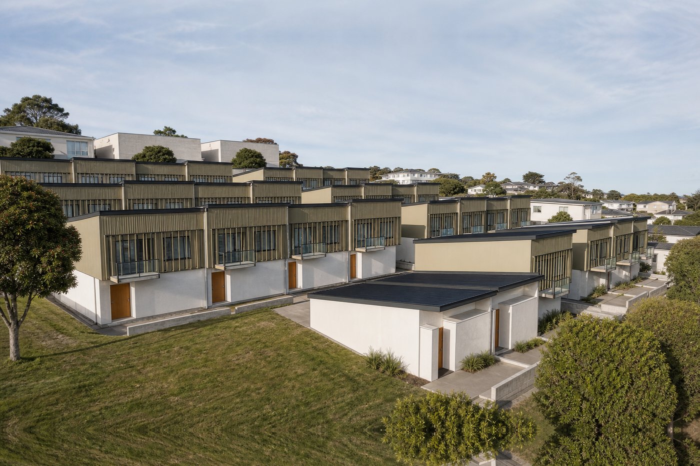
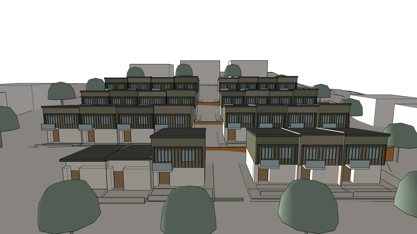
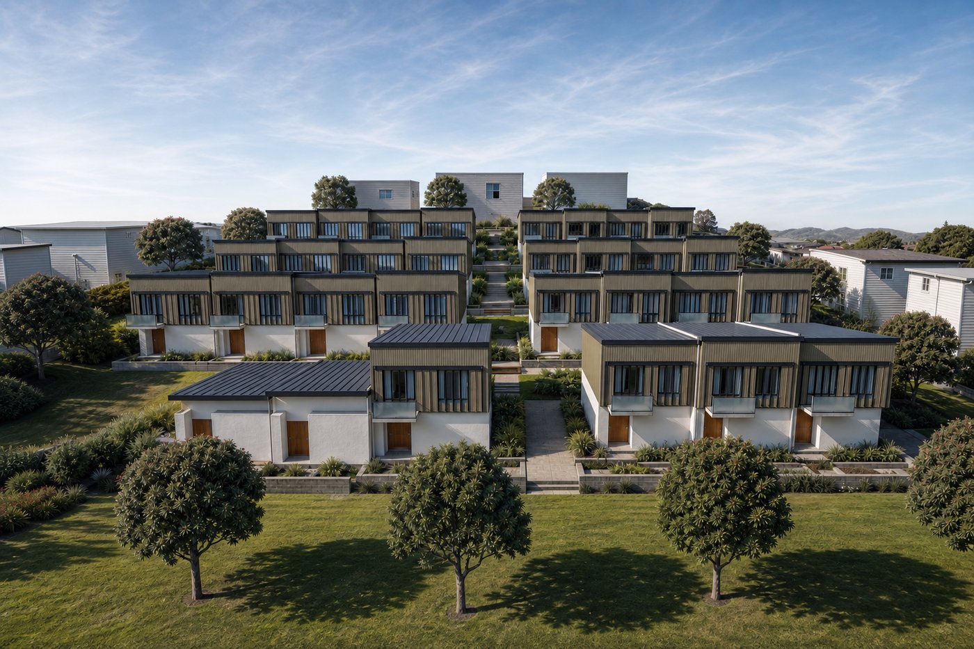
The working model establishes massing, dwelling mix and ground. Generated images add materials, planting and light while retaining the model camera and overall geometry. Publishing each image beside its model view keeps the differences visible.
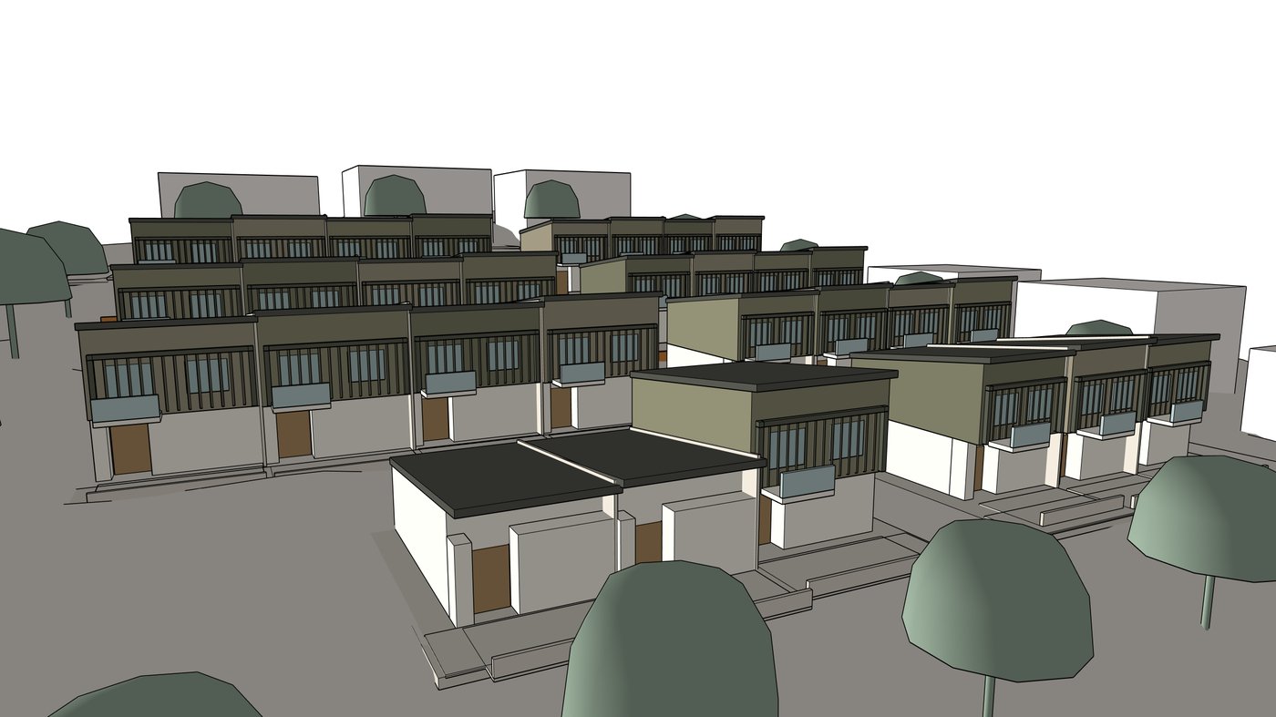 Model view
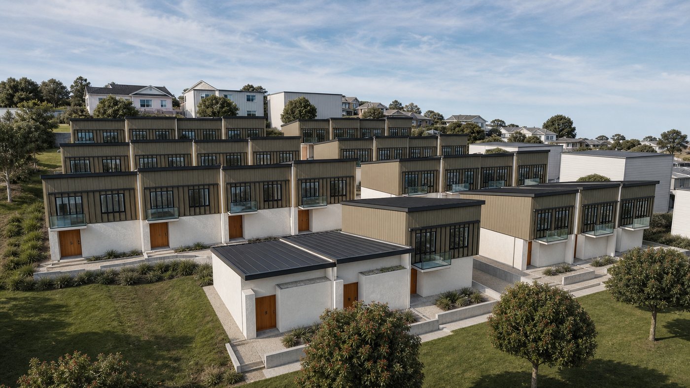 Generated frame
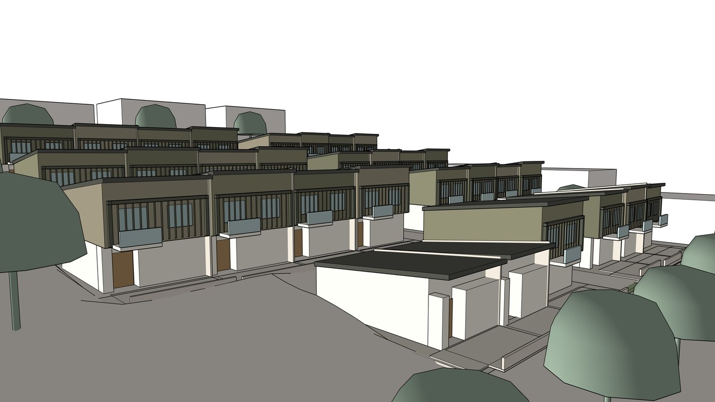 Model view
 Generated frame
 Model view
 Generated frame
A decision requires a clear line between established evidence, scenario inputs and outstanding checks.
Established evidence
Information traced to a dated public or project source.
- Parcel and terrain dataThe LINZ parcel records 4,671 m². The LiDAR model records 16.1 metres of fall across the geocoded study area; a survey is required to confirm the ground within the title boundary.
- Consent decisionThe September 2022 decision records thirty homes and the stated bedroom mix.
- Tender dateThe marketing process closed on 15 April 2026. Current ownership and availability are not established.
Scenario inputs
Working assumptions used to test the opportunity.
- Proposed scheme and imagesLayouts, facades, planting and generated frames are design proposals, not records of the consented drawings.
- Sale pricesThe $779,000 two-bedroom input is advertised pre-sale pricing. The one- and three-bedroom values are inferred.
- Costs and residualThe $20,000 contribution allowance is unverified. The $1.17 million land residual depends on the stated cost, price, margin and finance assumptions.
Checks and owners
Evidence required before the pack supports an acquisition decision.
- Agent or valuerConfirm the market positionCheck current property status and replace advertised pricing with settled comparable sales and valuation advice.
- ArchitectReconcile the designReview the consented drawings, s127 variation and geotechnical report against the proposed scheme.
- Developer or cost adviserUpdate the commercial caseConfirm construction rates, development contributions, finance terms and the required margin.
This is an early desk study prepared from public data without the vendor's involvement. It is not a valuation or advice to buy or sell.
The pack gives three parties the same starting point.
The finished pack brings the site evidence, proposed scheme, commercial scenario and open investigations into one reviewable document. It gives the parties a common basis for deciding whether the opportunity should progress to professional due diligence.
A company version would hold the firm's project criteria, previous models, cost rates and evidence requirements in a repeatable process, then produce the same first view for each suitable listing.
- Standing
- Desk study on public data; an early massing and feasibility test
- Useful for
- Starting the agent, developer and architect conversation
- Still required
- Consented drawing review, s127, geotech, DC schedule, valuation
- Company version
- Own project criteria, past models, rates, evidence and document format
Source register. original Trade Me listing · consent and property files · LINZ one-metre elevation collection · advertised Paparangi pricing. Design references are linked in Section 04.