136 Chamberlain Road · Massey, Auckland
Reading a land-bank listing against the plan that exists today.
LINZ title · operative zoning · three costed futures · a scripted model · human review
A Trade Me listing pitched 6.2 hectares in Massey to developers and land bankers. I used open data and AI to test what the site is actually worth under the plan in force today.
In one working session, the study moved from the listing to the true title boundary from LINZ, the operative Auckland Unitary Plan zone, three futures costed with graded rates, a scripted 3D model of the one scheme the plan supports, generated imagery, and this page.
The interesting part is the gap. The listing says developers and land bankers. The zoning layer says Rural, Countryside Living, operative. Those two statements are priced about $7 million apart, and the whole study is really about which one a buyer would be paying for. I set the brief, made the calls and reviewed each output; the AI did the assembly.
- Elapsed
- ~3 hrsone working session
- Title
- 62,113 sqmLot 2 DP 134509, from LINZ
- Operative zone
- Countryside LivingAuckland Unitary Plan
- Futures costed
- 4hold, split, six titles, the bet
- Rates
- 18each graded for confidence
One chain, from a public listing to a costed answer, with a person reviewing each step.
The title, the zone and the ground, resolved before any opinion was formed.
The listing gives an address and a hectare count. LINZ gives the rest: one parcel, Lot 2 DP 134509 on title NA79B/684, 62,113 square metres on the survey-accurate boundary, with about 140 metres of frontage where Chamberlain Road runs along the northern edge.
The zoning check is the hinge of the whole study. Auckland Council's open data returns the operative Unitary Plan base zone at any point; every probe across this site returns the same answer, Rural – Countryside Living, operative. Not residential, not Future Urban. The nearest urban zoning stops on the other side of the road network at Westgate's edge.
Topo50 contours put the site between the 20 and 60 metre contours with the 40 metre line crossing the southern third: a rolling paddock, not a flat one. The scripted model simplifies this to a plane, and that simplification is listed in the faults section rather than hidden.
- Listing
- Trade Me 5975980385, by negotiation, tenanted dwelling
- Parcel
- Lot 2 DP 134509 · NA79B/684 · 62,113 sqm
- Source
- LINZ Primary Parcels, WFS, queried live
- Zone
- Rural – Countryside Living, operative (AUP base zone)
- Ground
- Between 20 m and 60 m contours; 40 m line crosses the south
- Anchors
- Neighbouring large-block RVs $2.65m and $3.15m (2024)
The plan that exists today supports about $2.5 million. Everything above that is the bet.
Future A is the one the listing implies: hold the land, keep the tenant, wait for Auckland to arrive. At the neighbouring rating valuations the numbers are plain: about $21,000 of net income a year against $150,000 to $185,000 of interest. The hold is not an investment; it is a fee paid annually for a ticket in the rezoning queue.
Futures B and C are what the operative zone actually permits. As of right, Countryside Living subdivision at a 2 hectare minimum yields two new titles beside the house: a subdivider clearing a 20 percent margin could pay about $1.81 million. With transferable rural site subdivision rights the minimum falls to 1 hectare and the block carries six titles; the same arithmetic supports about $2.50 million, right at the bottom of the rating-valuation band.
Future D is the reason the listing says land bankers. If this paddock were ever live-zoned residential it would be worth $9 to $15 million as raw urban land. There is no date and no probability attached to that sentence, which is exactly the point: the gap between $2.5 million and $9 million is not value, it is hope with a holding cost.
| Future | Titles | Supports paying | Standing |
|---|---|---|---|
| A · hold, tenanted the listing's implicit pitch | 1 | –$148k to –$184k per year | negative carry |
| B · as-of-right split, 2 ha min | 3 | $1.81m | permitted |
| C · six titles, 1 ha with transferable rightsmodelled | 6 | $2.50m | consentable path |
| D · the urban bet if ever live-zoned residential | — | $9.3m to $15.5m | no date, no odds |
Residuals solve for the most a buyer could pay and still clear a 20 percent margin, crediting the retained dwelling at its standing value. The bet line is deliberately not a residual: it cannot be costed honestly from a desk.
Six titles on the true boundary, drawn by the return rather than by the marketing.
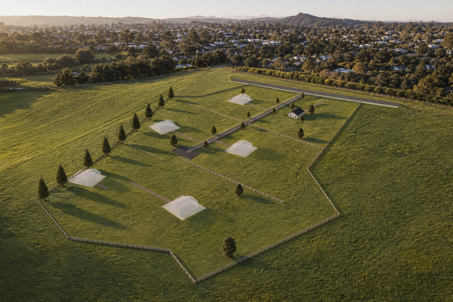
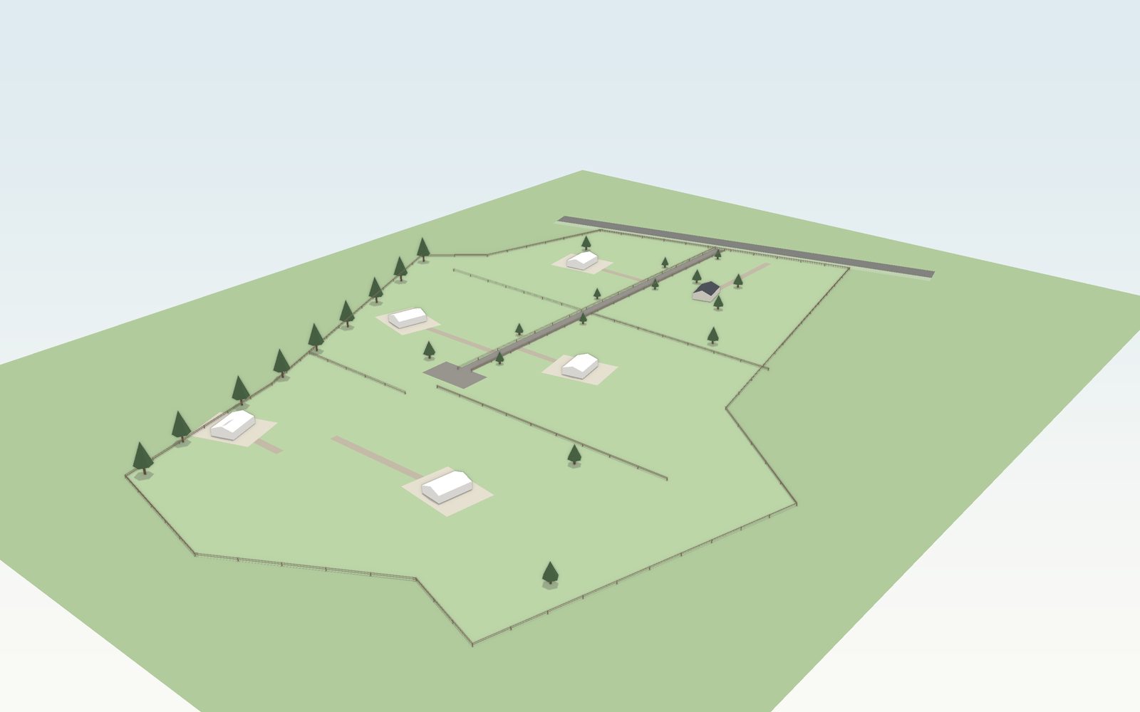
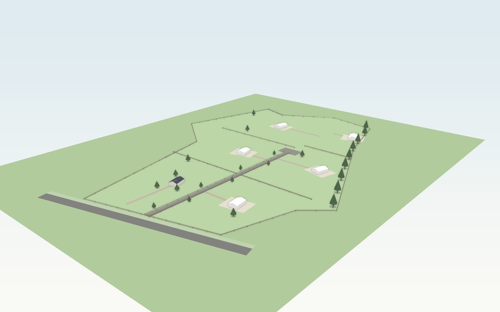
Future C was modelled: a 380 metre shared lane entering from the Chamberlain Road frontage, the existing dwelling retained on its own title at the north end, and five new lifestyle lots of roughly a hectare each, two east of the lane and three west, each with a building platform set off the lane and the existing shelterbelt kept along the western boundary.
The geometry is fully scripted: the same code that solved the residual lays out the lane, the lot fences, the platforms and the ghosted indicative dwellings, then writes the 3D model directly. Midway through this build the usual modelling seat died with its subscription, and it turned out not to matter. The chain runs on open data, code and review; the licensed tool was a convenience, not a dependency.
- Scheme
- 6 titles · house + 5 new lots at ~1.0 ha
- Lane
- 380 m sealed shared lane + hammerhead
- Model
- Scripted geometry, 2,931 triangles, COLLADA
- Renders
- Scripted raytracer, true sun angles
- Sun study
- 21 June, 09:00 / 12:00 / 15:00 NZST
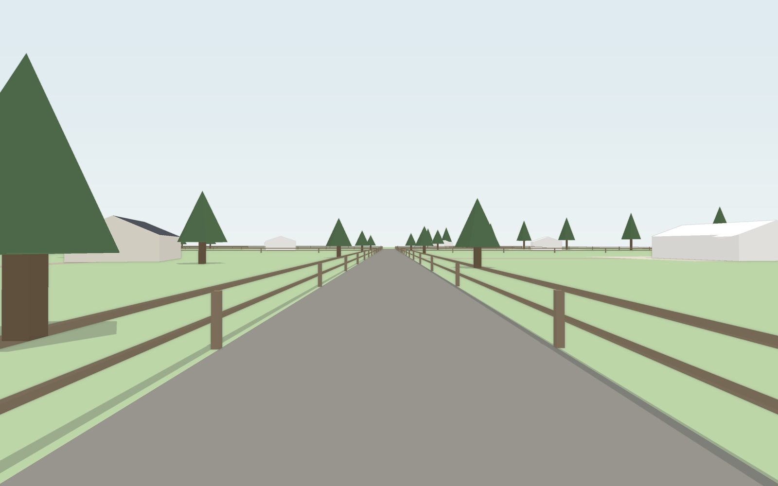
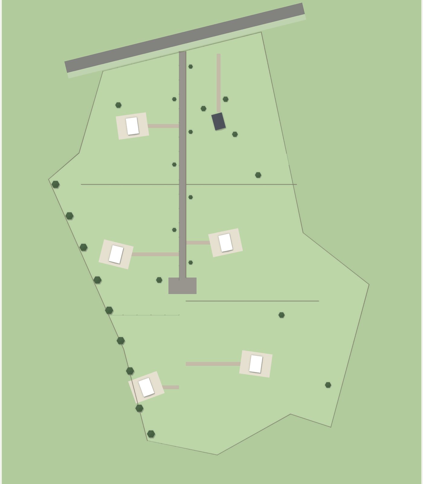
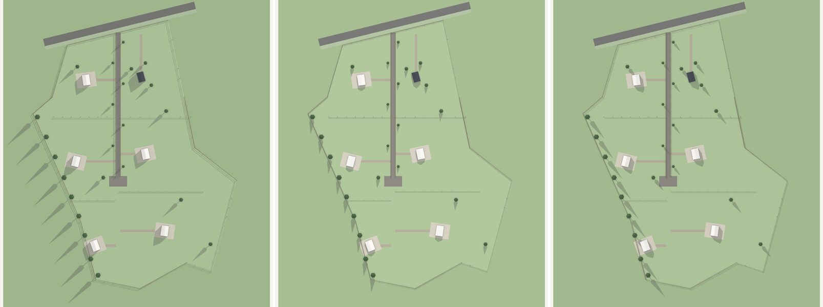
The model views became the imagery a campaign would carry.
The raytraced frames establish the geometry: the boundary, the lane, the platforms, the retained shelterbelt. Image generation then dressed the aerial in golden-hour light while holding the layout exactly. The result reads like campaign photography for a subdivision that does not exist, which is both the capability and the caution.
Every generated frame was checked against the model before it was kept. Nothing here is a promise of a finished development; it is what the consentable scheme would look like from the air.
- Source
- Scripted model views
- Method
- Image-to-image, layout held
- Check
- Each frame reviewed against the model
Eighteen rates, each carrying its confidence grade, and the weakest ones named.
The six-title residual is built from a lane at $1,400 a metre, services at $75,000 a lot, consent and titles at $32,000 a lot, four transferable rights, contingency, sales costs and twenty months of finance. Solve for the land price that leaves a 20 percent margin and the answer is $2.50 million.
The three weakest rates carry most of the answer, and none can be settled from a desk: the bare-lot sale price (no clean 1 hectare comp was retrievable), the value of the retained dwelling, and the price of a transferable subdivision right, which trades in a market thin enough that every deal is a negotiation. All three are graded LOW and listed as open items, the same way the barge rate was in the Aotea study.
- Gross, future C
- $5.28m · five lots + the house lot
- Civils + services
- $907k · lane, power, fibre, water
- Transferable rights
- $300k · four at $75k, LOW grade
- Residual at 20%
- $2.50m for the whole property
- Lowest confidence
- Lot price, dwelling value, rights price
The study turned on a handful of review decisions.
Check the zone before believing the headline.
The hingeThe listing says developers and land bankers. One open-data query says Countryside Living, operative, at every probe point. Every number in the study flows from choosing to price the plan, not the pitch.
Two hectares as of right, one with rights.
Rule found in the marketThe subdivision minimums came from comparable Countryside Living marketing, then set the two consentable futures. Confirming them against the plan text is a named open item.
The modelling seat died mid-build. Keep going.
Toolchain decisionThe SketchUp subscription lapsed with the model half-planned. The builder was rewritten to emit geometry directly, and the chain lost its only licensed dependency.
The model is flat. The site is not.
Honesty over polishContours show up to 20 metres of fall. Flattening it was the right trade for a three-hour study, and the right thing to disclose next to the renders.
Do not cost the bet.
The line that holdsThe urban upside appears as a range with no residual attached. Pricing hope as if it were consentable yield is how land-bank listings mislead.
Five limits that keep this a study rather than advice.
No bare-lot comparable
The lot price driving 80 percent of the revenue is a LOW-grade anchor. A registered valuation would move the residual materially in either direction.
Subdivision rules unverified
The 2 ha / 1 ha minimums come from market evidence, not from reading E39 and the precinct maps against this parcel. A planner settles this in an hour.
Flat model, rolling site
The lane grade, platform cuts and stormwater paths all change with real terrain. LiDAR exists for this site and is the first upgrade.
No services investigation
Power, water and wastewater capacity at the boundary were assumed at rural standard, not confirmed with the utilities.
The owner was not involved
This is a method study built entirely from public data about a publicly marketed property. It is not a valuation and not advice to any party.
Three hours of machine-assisted work put a defensible number under a marketing claim.
A buyer reading this listing now has a framework: pay up to about $2.5 million and the operative plan underwrites the price; pay more and the premium is a priced bet on rezoning with a $150,000-a-year holding cost while it resolves. That framing took one session to build because the title, the zone, the model and the estimate all came from the same reviewed chain.
The same chain ran twice before this: a terrace scheme on a deadline sale in Porirua, and an eighteen-section subdivision on the Kapiti Coast. Different sites, different verdicts, one method. The pattern holds: the value is not the model or the render; it is an honest number, produced while the question is still live.
- Standing
- Desk study, public data only, no site visit
- Still required
- Valuation, planner check of E39, LiDAR terrain, services
- Sufficient for
- Deciding what the plan supports paying, before negotiating
- Method
- Same chain as the Aotea study, one licence lighter
What this page is. A method demonstration built from public data about a publicly marketed property, prepared without the owner's or agent's involvement. Figures are modelled from graded desk rates and are indicative only. This is not a valuation, not development advice, and not advice to buy or not buy. Anyone acting on this site needs a registered valuer, a planner and their own due diligence.
Put a site in, and imagery like this can come out the other end.
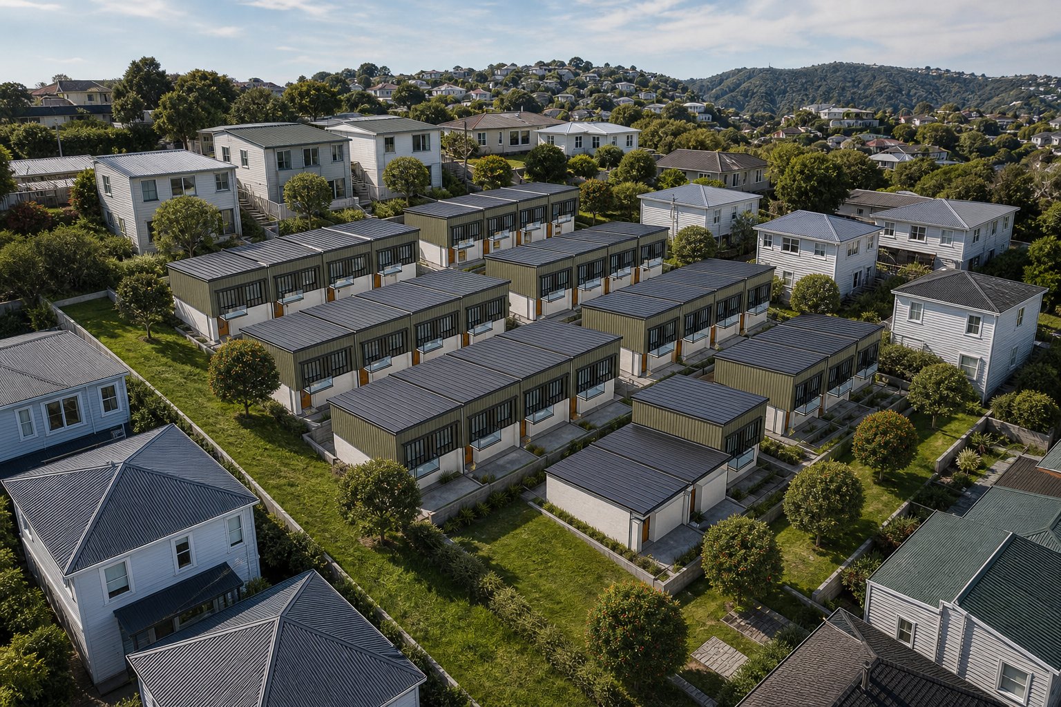
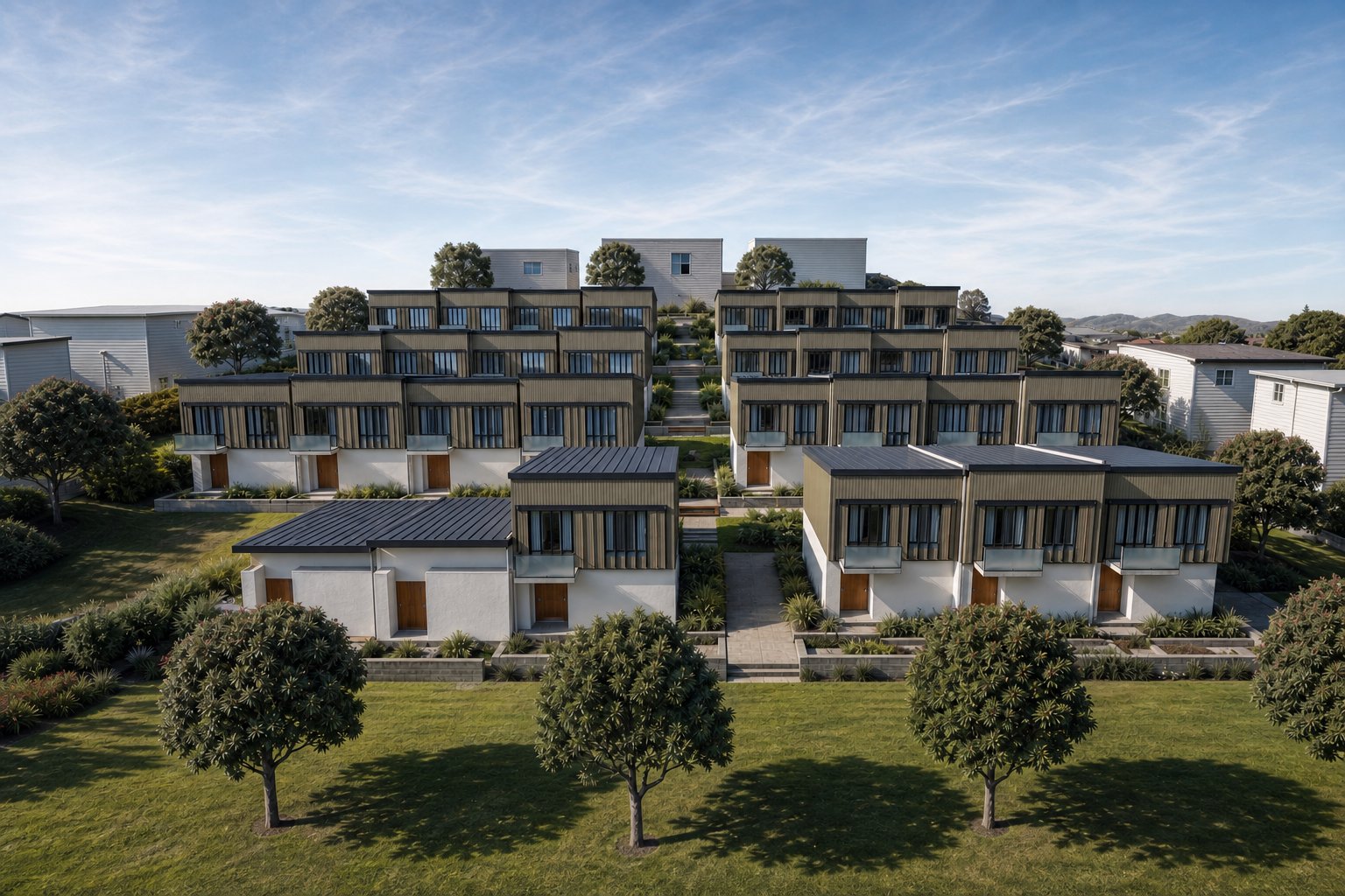
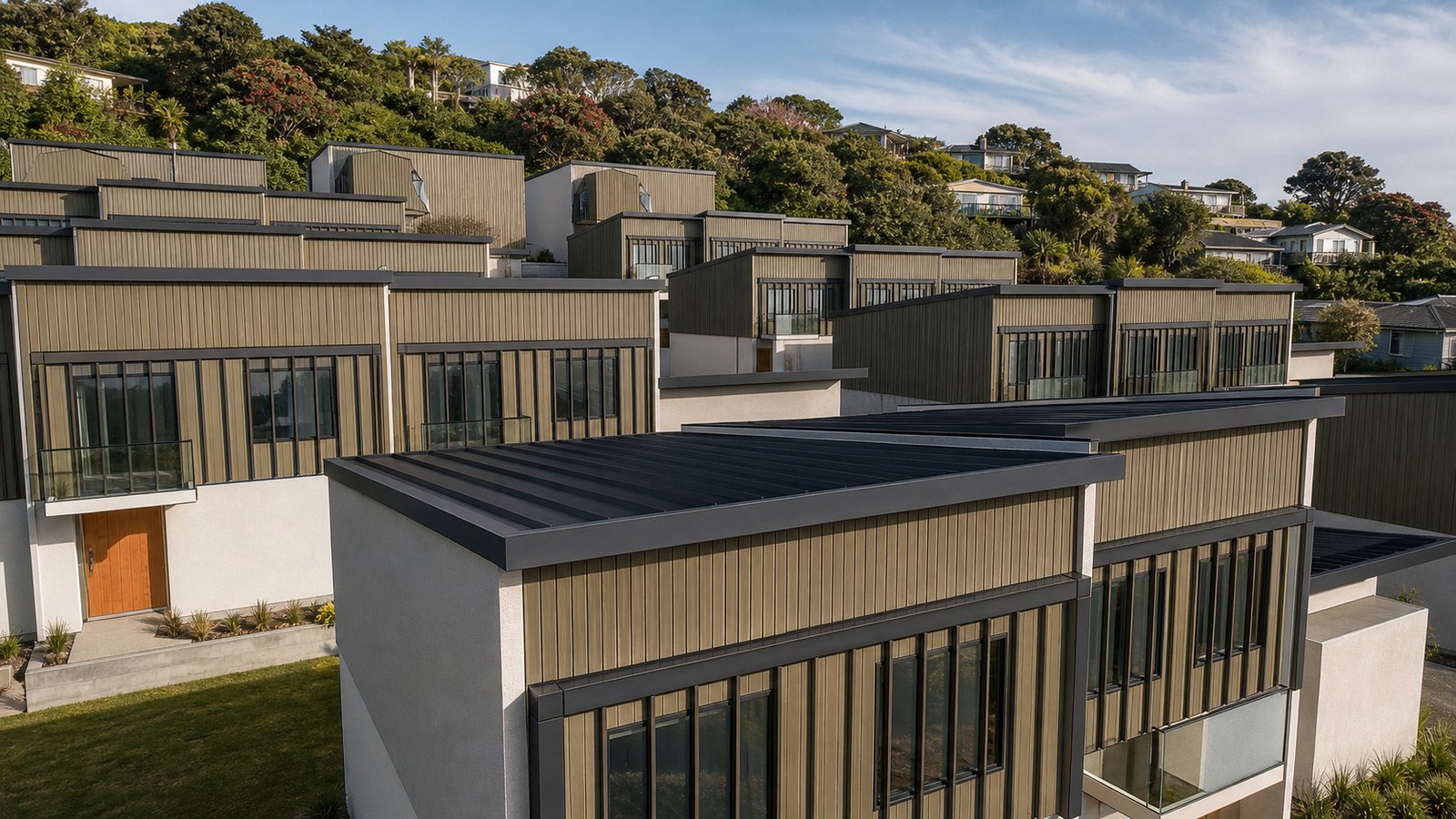
Chamberlain Road stopped at massing because the money said sections, not buildings. An earlier study in this series went the whole way. A Wellington hillside block in Paparangi was taken from its listing through the same chain, and out the far end came a designed scheme: cascade townhouses stepping down the true LiDAR slope, batten-clad and mono-pitched, dressed as campaign-grade imagery generated from the working model.
The design was worth showing. The feasibility backed it: the only site of five assessed with a positive residual, and the study said so on the same page as these images. That pairing is the whole point. Imagine typing a site into a tool that holds your firm's own rates, your buyers and your templates, and getting this back before the first meeting: the scheme, the imagery, and an honest number underneath it.
- Site
- 10 Hillview Crescent, Paparangi, Wellington
- Scheme
- Cascade townhouses on the true LiDAR slope
- Imagery
- Generated from the working model, layout held
- Verdict
- The one site of five that pencilled